


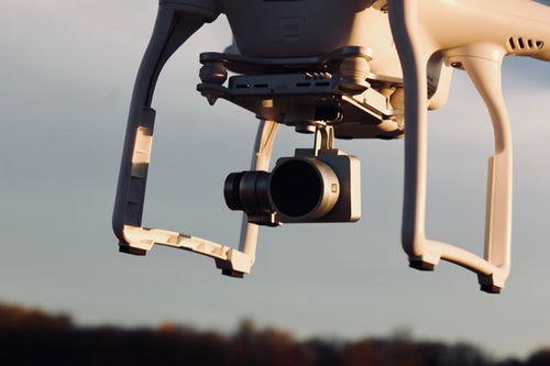
Drones are more than propellers, GPS and high resolution cameras. They come equipped with complex software solutions to aid users in controlling the drone and collecting data. UAV software is usually represented on the smartphone and another part of the software is placed inside the drone itself. The software that’s installed on smartphone could integrate with Google Earth to better calculate precise positioning based on the existing maps. There are many features that can be included on the user-side of the software. As an example, the smartphone app may allow users to set up a flight plan. It can be saved inside the app, so users can repeat the route as many times as they want. This should save plenty of effort and time.
The drone may also include a flight simulator software that can be installed on PC or smartphone. For new drone users, this is a good tool for learning how to control the flying device. They can start to learn lifting off and landing the drone, without potentially harming it, due to rough landing or crash. The flight simulator should include more difficult scenarios, such as maneuvering between trees and buildings. Users should know how to deal with emergency situations, such as during sudden rain or strong winds. Here are other types of drone software that you should know:
- Precise positioning: Precise positioning is crucial when you control the drone. These machines have limited flight time and you need to be productive due to the limited battery life. Precise positioning software may allow you to tell the drone to a spot based on GPS and Google Earth maps.
- Flight planning: With flight planning software, drone users could program a proper flight plan ensure productive and safe operation. It’s as easy as pointing on a position on Google Maps. Users can choose multiple waypoints and their GPS coordinates will be recorded. This software is useful for beginners with inadequate piloting skills.
- Real time flying: It’s almost similar to the flight planning software, except that users can do it at real time. After the drone lifts off and gains proper altitude, users can tap on any point on the map and drone will fly to the new destination. Change of directions can be performed at any time and it’s also a useful feature for beginners.
- Flight data analysis: This feature is available if the drone has a flight data recorder module that records status information and different variables. The software will decode data that it receives from the drone and process them into something that users can easily read and understand. The raw data can be recorded in the memory card for later processing or transmitted real time to the remote control unit.
- Telemetric data visualization: Telemetric data can be quite complicated, but they can be visualized using a special program. The output should be line diagrams that are easy to understand, as well as some important values. These data should be useful for optimizing future flights to improve productivity.